Continents
Earth's large land masses that are divided into seven areas - Seven main continuous expanses of land
- North America
- South America
- Europe
- Africa
- Asia
- Australia
- Antartica
Does a map and a globe show the same picture?
To see how the image on the globe is transformed into a map CLICK HERE

Islands
A mass of land that is surrounded by water and is smaller than a continent
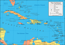
some islands pictured:
some islands pictured:
- the Bahamas
- the British Virgin Islands
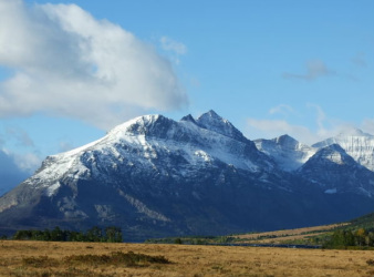
Mountains
Large natural elevation of the earth's surface rising abruptly from the surrounding area
Canyons
A deep narrow valley having high, steep slopes - a ravine formed by a river in an area with little rainfall

What other landforms do you know?
CLICK HERE for an interactive map

BODIES OF WATER

US GEOGRAPHY
